Page 1 of 1
kml draw line to stations
Posted: 13 Mar 2021, 11:22
by M0ZEH
Is it possible to draw lines between the stations plotted on google earth and my station. I think it maye be a feature in the kml file?
Re: kml draw line to stations
Posted: 14 Mar 2021, 10:58
by G4POP
M0ZEH wrote: 13 Mar 2021, 11:22
Is it possible to draw lines between the stations plotted on google earth and my station. I think it maye be a feature in the kml file?
Already there see Page 47 and note 'Connections'
Re: kml draw line to stations
Posted: 28 Mar 2021, 09:54
by M0ZEH
Kinda works but my location is offset when displayed on Google earth. My location is correct in log4om. I can't seem to add an attachment .jpg to show you a picture of what I mean it says file too big at 276Kb.
Re: kml draw line to stations
Posted: 28 Mar 2021, 09:59
by M0ZEH
If I select one qso it plots my whole logbook.
Re: kml draw line to stations
Posted: 28 Mar 2021, 10:07
by G4POP
M0ZEH wrote: 28 Mar 2021, 09:59
If I select one qso it plots my whole logbook.
Did you right click on the QSO and choose 'Selected to KML connections'? works for me!

- Capture.JPG (53.81 KiB) Viewed 3186 times
Re: kml draw line to stations
Posted: 03 Apr 2021, 13:04
by M0ZEH
No I selected kml connection map at the bottom. If you have 1 record selected the whole logbook is plotted. If you select 2 records only the first record is plotted.
Re: kml draw line to stations
Posted: 03 Apr 2021, 13:22
by G4POP
M0ZEH wrote: 03 Apr 2021, 13:04
No I selected kml connection map at the bottom. If you have 1 record selected the whole logbook is plotted. If you select 2 records only the first record is plotted.
Not sure what your doing wrong but it works fine here
1. In Recent QSO window I selected 4 QSO's using Ctrl/Left mouse click as in normal Windows selection methods as below.
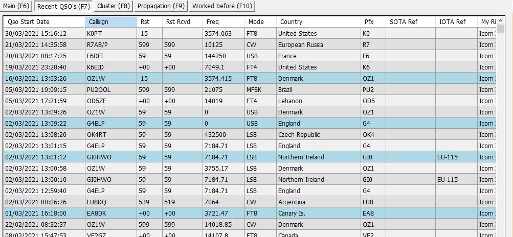
- Capture.JPG (127.54 KiB) Viewed 3113 times
2. I then Right mouse clicked on one of the highlighted QSO's and selected 'Selected to KML Connections' with the result that GE displays the four stations selected
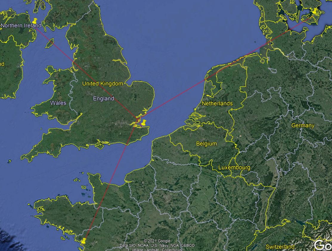
- Capture2.JPG (209.65 KiB) Viewed 3113 times
Re: kml draw line to stations
Posted: 30 Apr 2021, 11:10
by M0ZEH
Just had another go with the google map. If I select one record it plots my whole logbook. If I seclect 2 it plots one. If I select 3 it plots 2. The other thing I noticed is that if you set the My Grid Square to a 10 digit code it plots the lines very accurately from my location, which is good. The weird thing is, when a qso is logged from FT8 it only saves my grid sqaure as a 4 digit code. Is it possible to log my full 10 digit code for every QSO?
I'm using log4om 2 V2.13.0.0.
Re: kml draw line to stations
Posted: 30 Apr 2021, 11:16
by M0ZEH
Ah I can answer the grid question myself. The grid is sent from the ft8 software and the maximun number of digits allowed is 6.